Website:
Specialization:
Professor, Department of Geography
Bio:
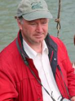
Keith C. Clarke is a research cartographer and professor of geography at UC Santa Barbara. He holds an M.A. and Ph. D. from the University of Michigan, specializing in analytical cartography. His most recent research has focused on environmental simulation modeling, on modeling urban growth using cellular automata, on terrain mapping and analysis, and on real-time visualization.
He is the author of three textbooks in eight editions, and more than 150 book chapters, journal articles, and papers in the fields of cartography, remote sensing, and geographic information systems. Chair of the National Academy of Sciences Mapping Sciences Committee from 2004-2010, Keith also chaired National Research Council studies on the National Map and for the National Geospatial Intelligence Agency, and served on the USGS Geography Discipline long term science planning team, for which he received the John Wesley Powell Award in 2005. He currently serves on the Board on Research Data and Information for the National Academies, on the National Geospatial Advisory Committee, and on National Geographic Society's Committee on Research and Exploration. His interest in digital games comes from developing the ability to pass massive engineered 3D models of environments into game-compatible formats.
Research:
3D models; cartography; mapping; remote sensing; simulation models
Publications:
Clarke, K. C. (2014) Cellular Automata and Agent-Based Models. Chapter 62 in Fischer, M. M. and Nijkamp, P. (eds) Handbook of Regional Science. Springer-Verlag, Berlin Heidelberg.
Li, Y. and Clarke, K. C. (2013) Image deblurring for satellite imagery using small-support-regularized Deconvolution. ISPRS Journal of Photogrammetry and Remote Sensing. 85, 148–155http://dx.doi.org/10.1016/j.isprsjprs.2013.08.002
Pingel, T. J., Clarke K. C., & McBride, W. A. (2013). An Improved Simple Morphological Filter for the Terrain Classification of Airborne LIDAR Data. ISPRS Journal of Photogrammetry and Remote Sensing, 77, 31-30.

